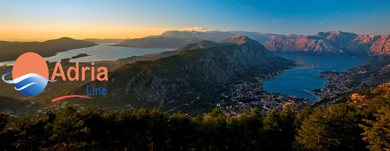
The Bay of Boka Kotorska
No matter whether you enter Boka by land or by sea - your experience will
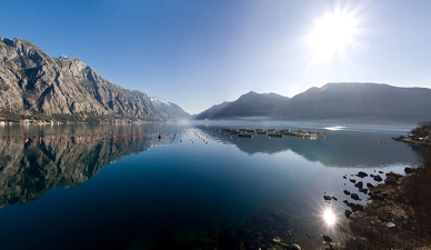
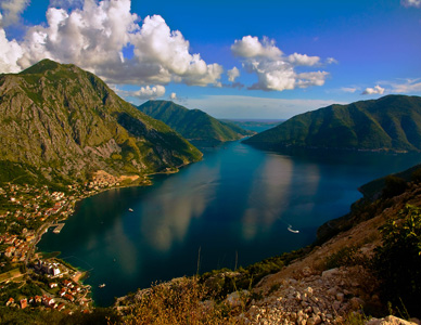
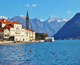
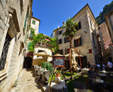
the same - Boka will fascinate you! It looks as if the mountains have cracked and let the sea in. This is the southernmost fjord in Europe. The high mountains bend over the thin coastline thus protecting it from the severe climate from the north. That is why Boka is an oasis of Mediterranean vegetation: agave, palm, mimosa, oleander, kiwi, pomegranate, medicinal herbs. When its peaks are covered with snow, the roses bloom in the foothills.
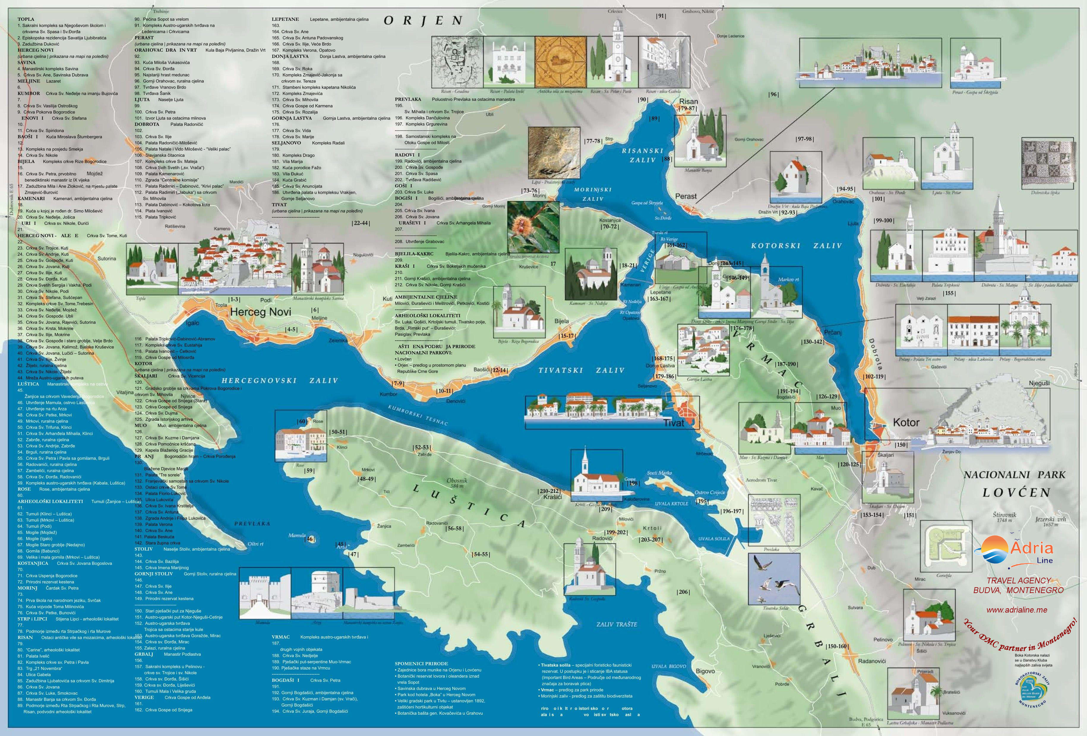
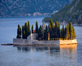
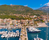
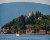
The most complex morphological entity is the Bay of Boka Kotorska, which consists of four enlargements interconnected by straits. At the entrance by the sea there are the Bay of Herceg Novi and the Bay of Tivat, which are interconnected by the Strait of Kumbor. Going inward, you enter the Bay of Risan and the Bay of Kotor, which are connected with the Bay of Tivat by a narrow maritime entity called Verige. The Bay of Boka Kotorska is one of the most beautiful bays in the world. It is 30 km long by the medium line and 1.500 m wide at the entrance. The shore length is 106 km, and the sea surface 88 kmn. The border of the Bay of Boka Kotorska is represented by steep and high slopes of mountains Orjen, towards Krivosije, and Lovcen, towards Njegusi. At the entrance of the Bay of Boka Kotorska, there is a rocky island and fortress Mamula from 1850. There are 7 islands in the Bay of Boka Kotorska, and the largest among them by surface is St. Marco (the old name: Stradioti), followed by the Island of Flowers, Mamula (Lastavica), St. George, Lady of Skrpjela, Milosrda (Otok), while the tiniest island is the Little Lady. The towns in the Bay are interco-nnected by road and maritime communications. They also make a part of the entire attractiveness of the Bay. The maritime communications are maintained through local and line navigation. The key role in the road communications has the Adriatic Highway, which frames the Bay linking the shore towns. The narrowest part of the Bay is the Strait of Verige, where the construction of a bridge is projected, but it has not been realised so far, so that in this part a ferry navigates between Lepetani and Kamenari, whereby the length of the Adriatic Highway is considerably cut down.
The mutual connection and unity of natural and anthropogenic motives make the Adriatic Sea the unique landscape entity, not only in the European Mediterranean, but also generally in the world. The warm sea, a pleasant climate, the Mediterranean vegetation, the specific animal world, the archaeology sites, small and big towns are the unique richness of our sea and Riviera.